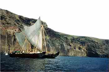
"In the 14th century when the first European explorers started their voyages of discovery, the Polynesians had already localized and inhabited almost all islands in the Pacific, without the use of navigation instruments. They observed the stars, the sea and the birds to navigate over distances of several thousand nautical miles, and often the highest point on the islands was a palmtree.
At this time the Europeans had great problems to navigate. The biggest challenge in the 15th and 16th century was to find methods to make navigation accurate. It was possible to determine the degree of latitude with the astrolabium, the quadrant, the nautical table, and later on the sextant. But it was more difficult to determine the degree of longitude, because they lacked the instruments to measure speed and time. In 1577 the English invented the log, but the problem was not solved until the chronometer was developed by the end of the 18th century.
It is unknown, how common it was for the Polynesians to use charts. On the Marshall islands charts have been found cut in the shell of fruits, and on Hawaii chiefs have tatooes, which could be charts."